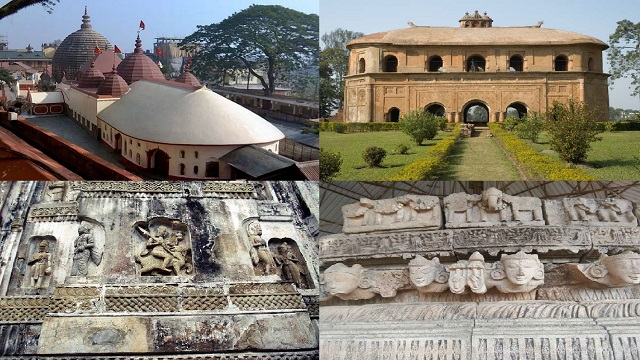
Assam, the North-Eastern sentinel of the Frontiers of India, is a state richly endowed with places of tourist attraction. Assam is described as the second largest after Arunachal Pradesh, of the 'Seven-Sisters' comprising the North-Eastern States of the country. Located in the foothills of the Himalayan Mountains, Assam is known as the land of red rivers and blue hills. With an area of 78,438 sq km, it constitutes about 2.39 per cent of the total land area of the country.
Origin of the Name - Assam
The word 'Assam' is derived from the Sanskrit word Asoma meaning 'peerless' or 'unequalled'. The land whose bewitching picture is conjured by the name 'Assam' is, in fact, peerless, judged by her exquisite natural beauty, cultural richness and human wealth.
In the epic age, Assam was known as Pragjyotisa or the land of eastern astronomy. In Classical Sanskrit literature, Pragjyotisa is also called Kamrupa. A graphic account of the geography of Pragjyotisa or Kamrupa is to be found in the Kalki Purana (10th Century) and the Yogini Purana (16th Century), both of which dwell upon the religio-geographical history of medieval Assam.
According to some other historians, the ancient name of Assam was Pragjyotishpura - the city of eastern light, which later changed to Kamrupa - the land where Kamadeva, the god of love was re-born.
The modern name of the province, Assam is of recent origin. It is connected with the Ahoms who entered the Brahmaputra valley at the beginning of the 13th century. They say that this was the term applied to them by the native tribes at the time of their invasion of the valley, and was an index of the awe and admiration with which the latter regarded the Ahom conqueror who conciliated them.
Location
The state, being T-shaped, is situated in the heart of the North-East corner of the Indian subcontinent. The area of Assam extends from the latitude 24°10'N to 27°58'N and longitude 89°49'E to 97°26'E between the foothills of eastern Himalayas and the Patkai and Naga Ranges.
Boundaries
Assam shares international borders with two countries - Bhutan to the north and Bangladesh to the west.
Assam is surrounded by Arunachal Pradesh on the north; Nagaland, Manipur, and Arunachal Pradesh on the east; Mizoram, Meghalaya, and Tripura on the south; and Meghalaya and West Bengal on the west. Assam is connected with the rest of the Indian Union by a narrow corridor called the Chicken's Neck or Bottle Neck in West Bengal that runs for 56 km below the foothills of Bhutan and Sikkim.
Physiography
Geographically, Assam is a shadow of its former self. It has been reduced to one-third of its original size in thirty years' time.
By virtue of its geographical location, Assam occupies a strategic position in the political map of India. The state forms the core of the north-eastern region of the country and provides the focal point of transport and communication lines serving its neighbouring states.
Assam, as it is today, may be divided into three important physical regions: (a) Brahmaputra valley, (b) Barak or Surama valley, and (c) the hilly areas of Karbi Anglong and North Cachar Hill districts.
Climate
The climatic condition of Assam differs from the rest of the country. It is humid, tropical type in the plains and subalpine in the hills, with heavy rainfall and vegetation in green all year round. The average temperature in summer and winter is 36-degree Celsius and 6-degree Celsius respectively.
The winter season extends from the month of October to February and rains predominate the rest of the year. Fairweather coupled with a fall in temperature follows the withdrawal of monsoon.
Rainfall
Rainfall in Assam is one of the highest in the world. It varies between 178 and 305 cm. All this rainfall is concentrated mainly in four months, June to September.
The unique physiographic features of the State and its surrounding mountain and hill ranges affect the areal distribution of rainfall. In general, the hills and foothills receive more rainfall. Besides, the districts of Tinsukia, Dibrugarh, Sivasagar, Dhemaji, Lakhimpur, Kokrajhar, Baksa, Dhubri in the Brahmaputra valley and the southernmost districts of Cachar, Hailakandi, and Karimganj enjoy annual rainfall of more than 250 cm on average.
On the other hand, Nagaon and Karbi Anglong districts receive relatively low rainfall, having the lowest in the Lanka-Lumding area (average annual rainfall of 129 cm) due to its location on the leeward side of the Meghalaya plateau and Karbi Hills.
Assam at a Glance
- Capital : Dispur
- Area : 78,438.08 sq km
- Total Polpulation : 3,12,05,576
- Male Population : 52%
- Female Population : 48%
- Urban Population (2011) : 14%
- Rural Population (2011) : 86%
- Schedule Tribe (2011) : 38,84,371 (12.41% of total population)
- Schedule Caste (2011) : 22,31,321 (6.85% of total population)
- Population Density (persons per sq km) : 398
- Sex Ratio : 958 Female per 1000 Male
- Total Districts : 33


0 Comments